
OUR TOOL
SPACE SATELLITES WE WORK WITH
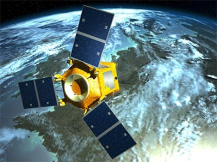
KazEOSat-1
KazEOSat-1 is Kazakhstan's first Earth observation satellite. It was built for the Government of the Republic of Kazakhstan by the European company Airbus Defence and Space (formerly EADS Astrium) using the Leostar-500-XO satellite platform.
On April 30, 2014, KazEOSat-1—Kazakhstan's first high-resolution Earth observation satellite—was successfully launched from the Kourou space center in French Guiana.
The satellite carries the NAOMI (New AstroSat Optical Modular Instrument) scanning payload, which enables imaging with a resolution of up to 1 meter (in panchromatic mode) and up to 4 meters (in multispectral mode).
Name: KazEOSat-1
Customer: JSC "NC 'Kazakhstan Gharysh Sapary'"
Manufacturer: Airbus Defence and Space (formerly EADS Astrium)
Platform: Leostar-500-XO
Orbit: Sun-synchronous, altitude 750 km, inclination 98.5 degrees
Dimensions: 2.10 m × 3.70 m
Power: 1200 W
Data transmission rate: 270 Mbps (X-band)
Data transmission modulation: QPSK
Mass: 820 kg
Design orbital lifespan: 7 years
Aperture diameter: 640 mm
Spectral channels
Panchromatic: 0.45–0.75 µm
Multispectral: Blue – 0.45–0.52 µm, Green – 0.53–0.60 µm, Red – 0.62–0.69 µm, IR – 0.76–0.89 µm
Spatial resolution: 1 m / 4 m
Radiometric resolution: 12-bit
Swath width: 20 km
Off-nadir pointing: +/- 35 degrees
Instrument mass: 150 kg
Stereo imaging capability: Yes (single-pass)
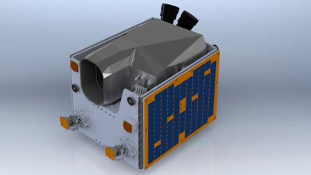
KazEOSat-2
KazEOSat-2 (Kazakhstan Earth Observation Satellite) is the second Kazakh Earth remote sensing satellite; it was built for the Government of the Republic of Kazakhstan by the British company SSTL, based on the "SSTL-150+" satellite platform. SSTL is a subsidiary of Airbus Defence and Space (formerly EADS Astrium).
The medium-resolution Earth remote sensing satellite KazEOSat-2 was launched on June 20, 2014, from the Yasny launch site in the Orenburg Region, Russia.
The KazEOSat-2 satellite carries the KEIS (Kazakh Earth Imaging System) scanning device as its payload; this instrument is also known as the "JSS-56" (Jena-Optronik Spaceborne Scanner-56) or "MSI" (Multispectral Imager).
The imaging capacity of the KazEOSat-2 spacecraft is 1,000,000 square kilometers per day.
Name: KazEOSat-2 | Customer: Kazakhstan Gharysh Sapary (KGS) | Manufacturer: SSTL | Platform: SSTL-150+ | Orbit: Sun-synchronous, H=630 km, inclination 98 degrees | Dimensions: 700 mm × 800 mm × 900 mm | Data transmission rate: 160 Mbps (X-band) | Mass: 180 kg | Design orbital lifespan: 7 years
Aperture diameter: 145 mm; Focal length: 633 mm; Spectral channels: Blue (0.45–0.52 µm), Green (0.53–0.60 µm), Red (0.62–0.69 µm), Far-red (0.69–0.73 µm), IR (0.76–0.89 µm); Spatial resolution: 6.5 m (nadir), 5 m (orthophoto generation); Radiometric resolution: 12-bit; Swath width: 77 km; Off-nadir pointing: +/- 35 degrees; Instrument mass: 150 kg; Stereo imaging capability: Yes (single-pass).
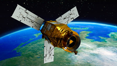
КА KOMPSAT-3
KOMPSAT-3 continues the series of Korean Earth observation satellites (Korean Multi-Purpose Satellite) and is designed to acquire digital images of the Earth's surface with a spatial resolution of 0.7 m in panchromatic mode and 2.8 m in multispectral mode.
Launch date: May 17, 2012. Launch site: Tanegashima Space Center (Japan). Launch vehicle: H-2A (Japan). Developers: KARI (Korea Aerospace Research Institute; Republic of Korea), EADS Astrium Satellites (France) (now Airbus Defence and Space). Operator: KARI. Exclusive data supply rights: Airbus Defence and Space. Mass: 1,000 kg. Orbit type: Sun-synchronous. Altitude: 700 km. Inclination: 98.1°. Design lifespan: 4 years.
Imaging mode: Panchromatic | Multispectral. Spectral range (µm): 0.45–0.90 | 0.45–0.52 (blue), 0.52–0.60 (green), 0.63–0.69 (red), 0.76–0.90 (near-IR). Spatial resolution (nadir, m): 0.7 | 2.8. Radiometric resolution (bits per pixel): 14. Swath width (km): 16.8.
- inventory of agricultural land, creation of land-use plans, precision farming;
a wide range of environmental protection tasks;
inventory of land holdings.
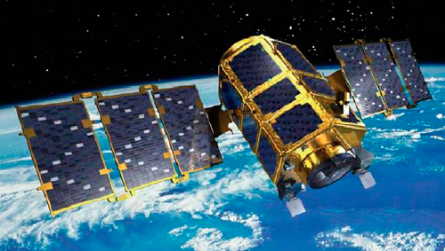
КА KOMPSAT-2
The KOMPSAT-2 (Korean Multi-Purpose Satellite) is designed to acquire digital images of the Earth's surface with a spatial resolution of 1 m in panchromatic mode and 4 m in multispectral mode. A distinctive feature of the satellite is its capability for extended continuous imaging—covering up to 120,000 square kilometers (533 scenes) in a single orbit.
Launch date: July 28, 2006
Launch site: Plesetsk Cosmodrome (Russia)
Launch vehicle: Rokot (Russia)
Developers: KARI (Korea Aerospace Research Institute; Republic of Korea), EADS Astrium Satellites (France) (now Airbus Defence and Space); Operator: KARI.
Exclusive data distribution rights: Airbus Defence and Space
Mass: 800 kg
Orbit
Type: Sun-synchronous
Altitude: 685 km
Inclination: 90°
Imaging mode: Panchromatic / Multispectral | Spectral range (µm): 0.50–0.90 / 0.45–0.52 (blue), 0.52–0.60 (green), 0.63–0.69 (red), 0.76–0.90 (near-IR) | Spatial resolution (nadir, m): 1 / 4 | Radiometric resolution (bits per pixel): 10 | Swath width (km): 15 | Revisit time (days): 3 | Stereo pair capability: Yes | File format: GeoTIFF | Data transmission rate to ground segment (Mbit/s): 320 | Minimum order area (sq. km): Archive data 50 / New acquisition 100
- creation and updating of topographic and specialized maps and plans at scales up to 1:10,000;
inventory and construction monitoring of oil and gas transportation and extraction infrastructure;
forest management operations, forest inventory, and condition assessment;
inventory of agricultural land, creation of land-use plans, and precision farming; - updating topographic base maps for the development of master plans for long-term urban development and territorial planning schemes for municipal districts;
- inventory and condition monitoring of transport, energy, and information infrastructure;
- a wide range of tasks related to environmental protection.
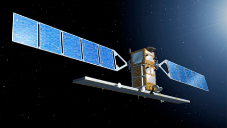
Спутники COSMO-SkyMed 1-4
The COSMO-SkyMed 1–4 satellites are equipped with a synthetic aperture radar capable of performing interferometric imaging of the Earth's surface with unprecedented spatial resolution (better than 1 m on the ground).
Operator: e-GEOS (Italy)
Mass (kg): 1,900
Orbit type: Circular sun-synchronous
Altitude (km): 514
Inclination (deg): 97.44
Design service life (years): 5
Spectral range: X-band (3.1 cm) | Radiometric resolution: 8 bits/pixel | Revisit time: 6 days (at the equator), 7 days (at 40° latitude) | File format: CEOS | Data transmission rate to ground segment: 300 Mbps | Mode | Nominal spatial resolution (m) | Swath width (km) | Imaging angle range (deg.) | Polarization | Ultra-high resolution (Spotlight) | ≤ 1 | 10 | 20–60 | Single (selectable: HH or VV) | High resolution (Stripmap) | 3–5 | 40 | Single (selectable: HH, VV, HV, or VH) | Medium resolution (ScanSAR Wide Region) | 30 | 100 | Low resolution (ScanSAR Huge Region) | 100 | 200 | Medium resolution, dual-polarization (Polarimetric) | 15–20 | 30 | Dual (selectable: VV/HH, HH/HV, or VV/VH)
- ensuring the defense and security of both Italy and other countries;
creation and updating of topographic and specialized maps at scales up to 1:10,000;
generation of high-precision Digital Elevation Models (DEMs) and Digital Surface Models (DSMs) (vertical accuracy of 2–4 m);
all-weather monitoring of natural and man-made disasters (floods, droughts, landslides, accidents);
seismic hazard assessment and forecasting of earthquakes and volcanic eruptions;
crop mapping, assessment of crop conditions, and precision agriculture;
monitoring of legal compliance.
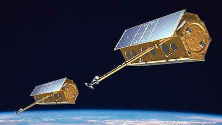
TerraSAR-X and TanDEM-X spacecraft
The TerraSAR-X and TanDEM-X spacecraft are equipped with state-of-the-art synthetic aperture radars capable of imaging the Earth's surface with high spatial resolution (up to 1 m). These satellites rank among the most advanced Earth remote sensing instruments. They operate in tandem; the data acquired from them will be used to generate a global digital terrain and elevation model that is unprecedented in terms of coverage area and accuracy.
Launch dates: June 15, 2007 (TerraSAR-X), June 21, 2010 (TanDEM-X). Operator: Astrium GEO-Information Services (an international company formed from Spot Image and Infoterra). Mass (kg): 1,250. Orbit type: Circular sun-synchronous. Altitude (km): 514. Inclination (deg): 97.44. Design lifespan (years): 5.
Spectral range: X-band (3.1 cm) | Radiometric resolution: 16 bits/pixel | Revisit time: 11 days (sub-cycle: 2.5 days) | File formats: CEOS, GeoTIFF | Data transmission rate to ground segment: 300 Mbps | Mode | Nominal spatial resolution (m) | Swath width (km) | Incidence angle range (deg.) | Polarization | Ultra-high resolution (High Resolution SpotLight - HS) | 1 | 10 | 20–55 | Single (selectable: VV or HH); dual (VV/HH) | High resolution (SpotLight - SL) | 2 | 10 | 20–55 | High-resolution wide-swath (StripMap - SM) | 3 | 30 | 20–55 | Single (selectable: VV or HH); dual (selectable: VV/HH or HH/HV or VV/VH) | Medium resolution (ScanSAR - SC) | 16 | 100 | 20–55 | Single (selectable: VV or HH)
- creation and updating of topographic and specialized maps at scales up to 1:10,000;
- creation of high-precision Digital Elevation Models (DEMs) and Digital Surface Models (DSMs) (vertical accuracy of 2–4 m);
- high-precision monitoring of infrastructure networks (pipelines, railways, telecommunications);
seismic hazard assessment and forecasting of earthquakes and volcanic eruptions; - all-weather monitoring of natural and man-made disasters (floods, accidents); coastal zone monitoring and vessel tracking;
- mapping of agricultural crops, assessment of crop conditions, precision agriculture;
- mapping of forest stands, determination of species composition without ground-based surveys, monitoring of clear-cut areas and forest health;
- monitoring and management of the urban environment;
- defense and security tasks.
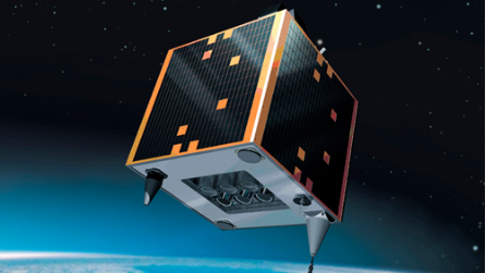
Deimos-1
The Deimos-1 satellite is equipped with a three-channel sensor (Green, Red, Near-Infrared) capable of acquiring data with a spatial resolution of 22 meters and a radiometric resolution of 8 or 10 bits.
Data from this satellite is supplied in both orthorectified GeoTIFF format and the raw (*.DIMAP) format.
Launch date: July 29, 2009. Operator: DEIMOS Imaging. Mass (kg): 120. Orbit type: Circular sun-synchronous. Altitude (km): 680. Inclination (deg): 98.13. Design lifespan (years): 5.
Modes: Multispectral (MS). Spectral range (µm): Green: 0.52–0.60; Red: 0.63–0.69; Near-IR: 0.77–0.90. Spatial resolution (m): 22. Swath width (km): 312 km per pass (typically two passes). File formats: GeoTIFF, DIMAP. Processing: Radiometric, sensor, and geometric correction; map projection alignment. Revisit time (days): 2–4 days. Stereo pair capability: No. Minimum order area: 10,000 km² for all data types.
- Imaging for agricultural, forestry, and other applications; environmental monitoring.
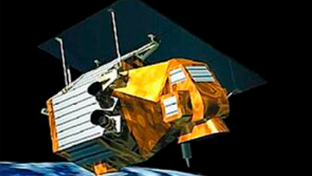
Formosat-2
The Formosat-2 spacecraft is designed to capture digital images of the Earth's surface in panchromatic and multispectral modes. The satellite images the surface using two cameras. It is distinguished by its maneuverability, the capability for daily imaging, and an earlier overpass time for any given location on Earth (9:30 a.m. local time, compared to 10:30 a.m. for most satellites), which increases the likelihood of obtaining cloud-free imagery.
Launch date: May 20, 2004. Operator: NSPO (National Space Organization; Taiwan). Exclusive data supply rights: Astrium GEO-Information Services (an international company formed from Spot Image and Infoterra). Mass: 764 kg. Orbit type: Sun-synchronous. Altitude: 891 km. Inclination: 99.1°. Design lifespan: 5 years.
Modes: Panchromatic (PAN), Multispectral (MS) | Spectral range (µm): 0.45–0.90 (Blue: 0.45–0.52; Green: 0.52–0.60; Red: 0.63–0.69; Near-IR: 0.76–0.90) | Spatial resolution (m): 2, 8 | Radiometric resolution (nadir): 8 bits per pixel | File format: GeoTIFF | Swath width (km): [Value not specified] | Corrections: Radiometric, sensor, and geometric (Level 1A/Level 2A); Level 3 Ortho (map projection) | Revisit frequency: Daily | Minimum order area: New acquisition 24×24 km (1 scene); Archive data 24×24 km (1 scene)
- Creation and updating of topographic and specialized maps, up to a scale of 1:25,000;
Ongoing supervision of the construction of oil and gas extraction and transportation infrastructure, and operational monitoring of its condition;
Continuous monitoring of the environmental status of areas involved in the extraction, processing, and transportation of oil, gas, and other mineral resources;
Operational assessment of ice and snow cover conditions;
Updating topographic base maps for the development of territorial planning schemes for municipal districts; - Forest inventory and forest management planning;
Ongoing control of forest use and operational monitoring of forest conditions;
Ongoing monitoring of erosion, karst processes, waterlogging, desertification, and soil salinization, as well as forest and steppe fires, high water, flash floods, etc.;
Monitoring of natural and human-induced disasters.
RapidEye
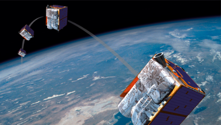
The RapidEye constellation of five mini-satellites is designed to address monitoring needs across a wide range of sectors. The satellites' specifications make them particularly well-suited for applications in agriculture and forestry, the oil and gas industry, the energy sector, telecommunications, thematic and specialized mapping, environmental monitoring and protection, and emergency management.
Earth surface imaging is conducted across five spectral channels. A unique feature for high-resolution satellites is the "red-edge" channel, which is ideally suited for monitoring and measuring changes in vegetation health.
Launch date: August 29, 2008. Operator: RapidEye (Germany). Mass (kg): 150. Orbit type: Sun-synchronous. Altitude (km): 630. Inclination (deg): 98.7. Design lifespan (years): 7.
Modes: Multispectral (MS) | Spectral range (µm): blue: 0.44–0.51; green: 0.52–0.59; red: 0.63–0.685; near-red: 0.69–0.73; near-IR: 0.76–0.85 | Spatial resolution (m): 5 | Radiometric resolution (bits per pixel): 12 | Geopositioning accuracy (m): 230 | Swath width (km): 77 | File formats: GeoTIFF, NITF | Processing: Radiometric, sensor, and geometric correction; map projection alignment | Revisit time (h): 24 | Stereo pair capability: No | Minimum order area (new and archival imagery): 3,500 km²
- inventory of agricultural land, creation of land-use maps;
monitoring of crop conditions, assessment of weed infestation, detection of crop pests and diseases, yield forecasting, precision farming;
monitoring of forest vegetation, forest inventory;
monitoring of natural and human-induced disasters; - monitoring the condition of oil and gas extraction and transportation infrastructure;
spatial planning and management of municipal and urban services;
updating road maps and other specialized maps at scales of 1:25,000 to 1:50,000;
monitoring the environmental condition of areas involved in the extraction, processing, and transportation of oil, gas, and other mineral resources.
SPOT-5
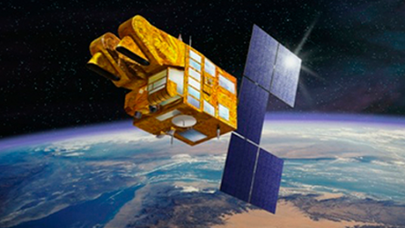
The SPOT-5 satellite is equipped with new sensors capable of imaging with a resolution of 5 meters in panchromatic mode and 10 meters in multispectral mode. The imaging swath width is 60 kilometers. A distinctive feature of the satellite is the "supermode," in which two cameras image the same area at 5-meter resolution; subsequent synthesis and additional processing yield a panchromatic or color-composite image with a resolution of 2.5 meters. The SPOT-5 satellite also carries the HRS camera, designed to acquire stereo imagery of the Earth's surface during a single pass. SPOT-5 stereo pairs are used to generate a global digital elevation model and to produce SPOT 3D derivative products.
Launch date: May 3, 2002. Operator: Astrium GEO-Information Services (an international company formed from Spot Image and Infoterra). Mass (kg): 3,000. Orbit type: Sun-synchronous. Altitude (km): 822. Inclination (deg): 98.7. Design lifespan (years): 5.
Modes: Panchromatic (PAN), Multispectral (MS), Vegetation 2. Spectral range (µm): 0.48–0.71; Green: 0.50–0.59, Red: 0.61–0.68, Near-IR: 0.78–0.89, Mid-IR: 1.58–1.75; Blue: 0.45–0.52, Red: 0.61–0.68, Near-IR: 0.78–0.89, Mid-IR: 1.58–1.75. Spatial resolution (m): 5 m (up to 2.5 m in SuperMode), 10 m, 1 km. Swath width (km): 60 (at nadir), 60 (at nadir), 1000 and 2000. Radiometric resolution: 8 bits per pixel, 8 bits per pixel, 10 bits per pixel. File format: GeoTIFF. Processing: Radiometric, sensor, and geometric correction; map projection alignment. Revisit time: 26 days (at nadir), 3–4 days (off-nadir). Minimum order area: New acquisition 60x60 km (1 scene); Archive data 60x60 km (1 scene).
- Creation and updating of topographic and thematic maps at scales up to 1:25,000.
Generation of digital elevation models with a vertical accuracy of 5–10 meters.
Inventory and construction monitoring of oil and gas extraction and transportation infrastructure.
Maintenance of land cadastres.
Assessment of the condition and degradation levels of agricultural and pasture lands.
Monitoring of environmental conditions in areas associated with the extraction, processing, and transportation of oil, gas, and other mineral resources. - Execution of forest management operations and forest inventory.
Regular oversight of forest use and monitoring of forest conditions.
Monitoring and forecasting of processes such as waterlogging, desertification, soil salinization, karst formation, erosion, steppe fires, etc.
Assessment of the environmental impacts of land development.
Pleiades-1А и Pleiades-1B
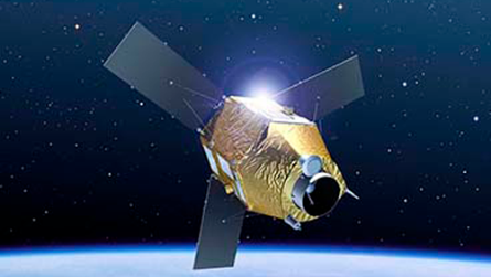
Pleiades is an optical-electronic Earth remote sensing system comprising two identical, very-high-resolution satellites: Pleiades-1A and Pleiades-1B. The satellites are synchronized in the same orbit to enable daily imaging of the same area on the Earth's surface. The Pleiades-1A and Pleiades-1B spacecraft possess unprecedented maneuverability, allowing them to image an area of over 1 million square kilometers each day.
Launch dates: December 16, 2011 (Pleiades-1A), December 1, 2012 (Pleiades-1B). Operator: Astrium GEO-Information Services (an international company formed from Spot Image and Infoterra). Mass: 1,000 kg. Design service life: 5 years.
Modes: Panchromatic (PAN), Multispectral (MS) | Spectral range (µm): 0.48–0.83 (PAN); Blue: 0.43–0.55, Green: 0.49–0.61, Red: 0.60–0.72, Near-IR: 0.79–0.95 (MS) | Spatial resolution (m): 0.7 (0.5 after processing) / 2.8 (2.0 after processing) | Maximum off-nadir angle (deg): 50 | Geopositioning accuracy (m): CE90 = 4.5 | Swath width (km): 20 | Imaging capacity (million sq. km/day): >1 | Revisit time (days): 1 (depending on latitude) | File format: GeoTIFF | Minimum order area: New acquisition 100 km² / Archive data 25 km²
- Creation and updating of topographic and thematic maps at scales up to 1:2,000. Inventory and construction monitoring of oil and gas extraction and transportation infrastructure. Maintenance of land cadastres; assessment of the condition and degradation levels of agricultural and pasture lands; environmental monitoring of areas associated with the extraction, processing, and transportation of oil, gas, and other mineral resources. Forest management planning and forest inventory; regular oversight of forest utilization and monitoring of forest health; assessment of the environmental impact of land development.

123456789
OUR SERVICES
ABOUT COMPANY
CONTACTS
-
Astana, Nura district, Turan avenue 89
National Space Center -
+7 (7172) 76 94 11 office
-
+7 (7172) 24 85 50 вн.305 Compliance - Officer
-
kense@gharysh.kz